3D Maps - United States
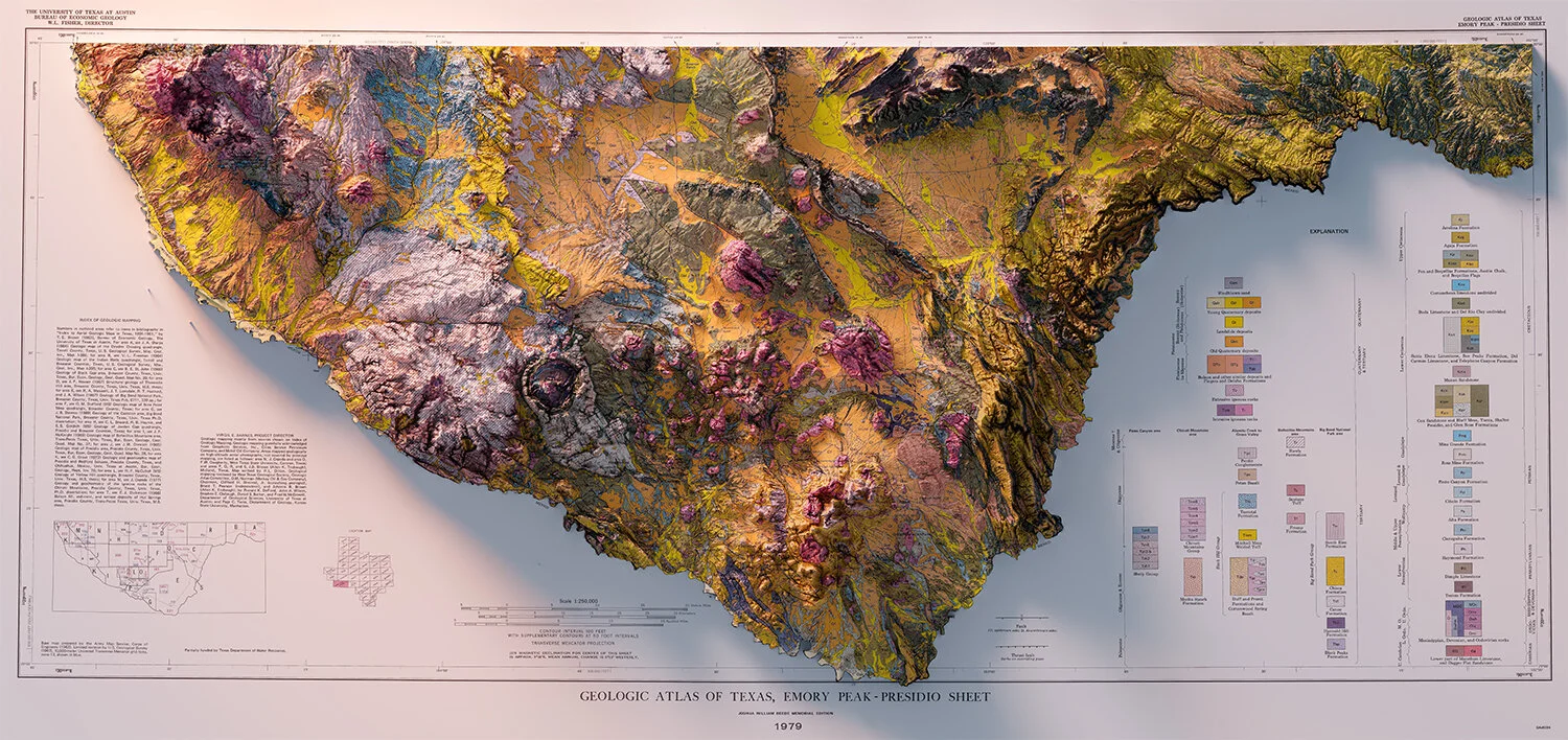
Big Bend - Texas
Geologic map - 1972 - University of Texas

Geology of North America
United States Geological Survey - 1911
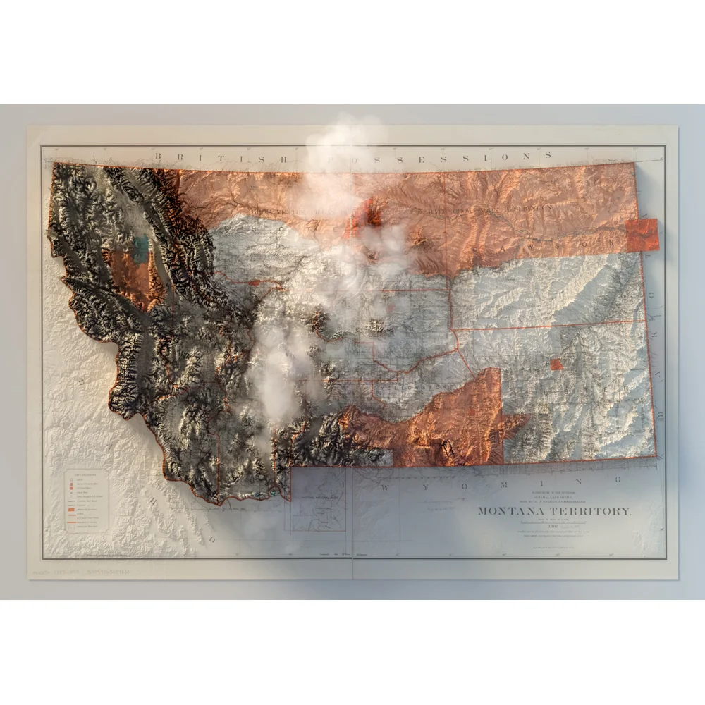
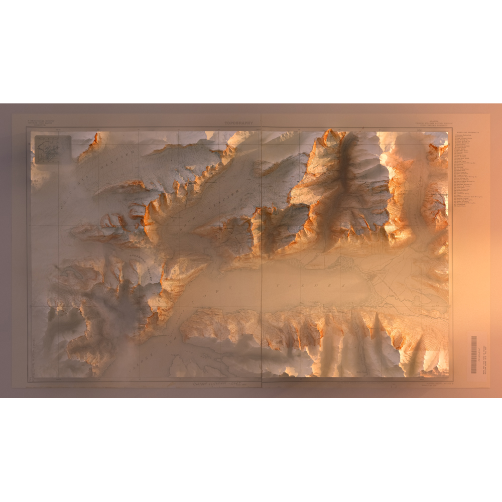
Yellowstone - Sources of Snake River
USGS map of 1907
Geological map of the United States - 1872

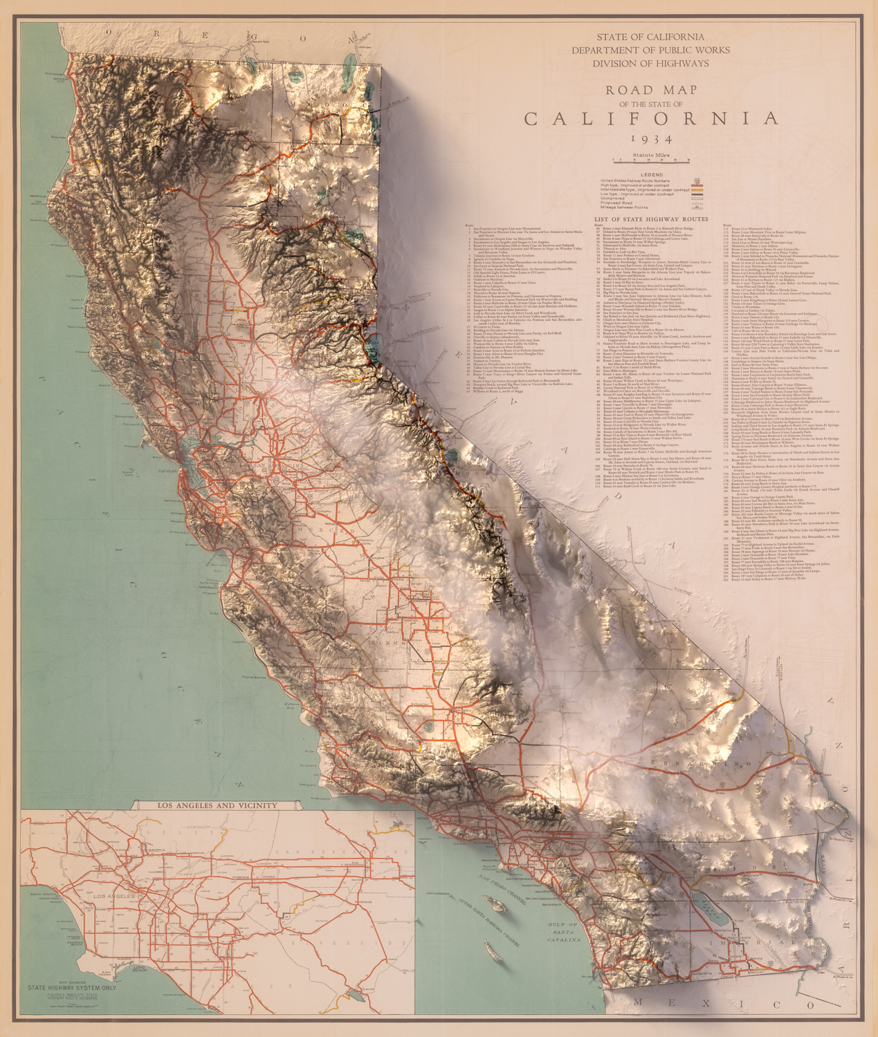
California
Road-Map - Department of Public Works - 1934


Placer County - California
Library Of Congress 1902
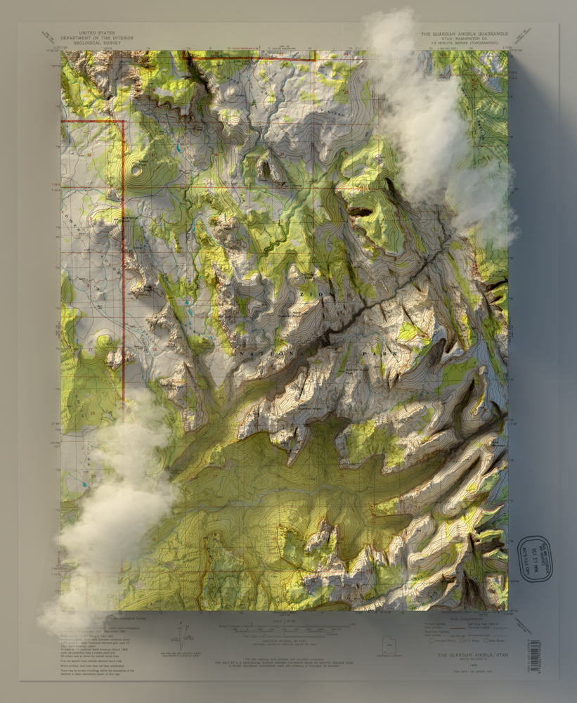
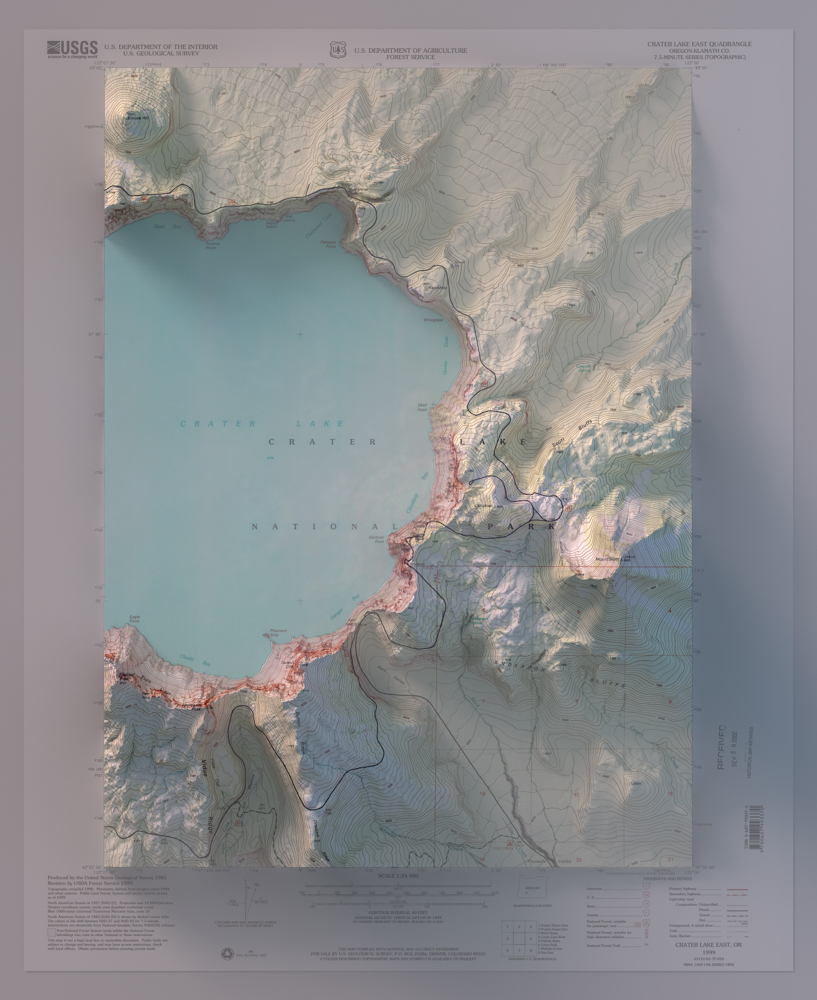
Zion National Park


Asheville - North Carolina - Tennessee
USGS map of 1985
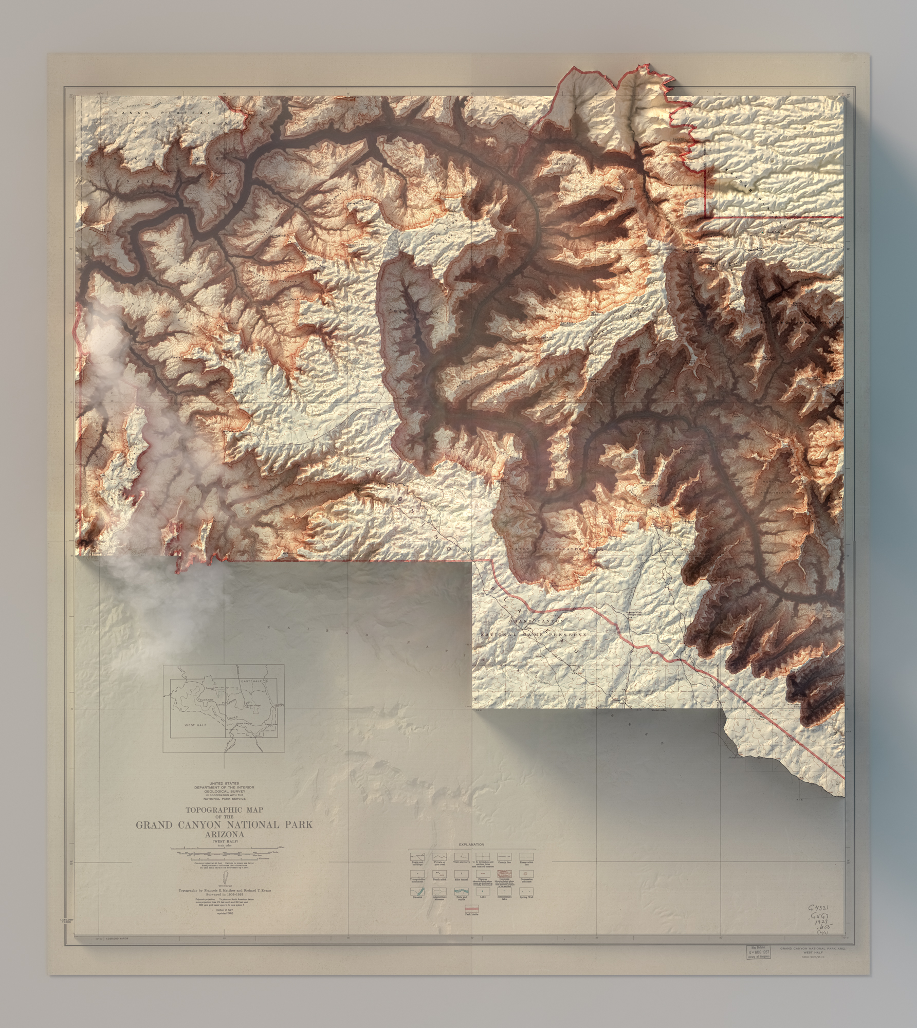
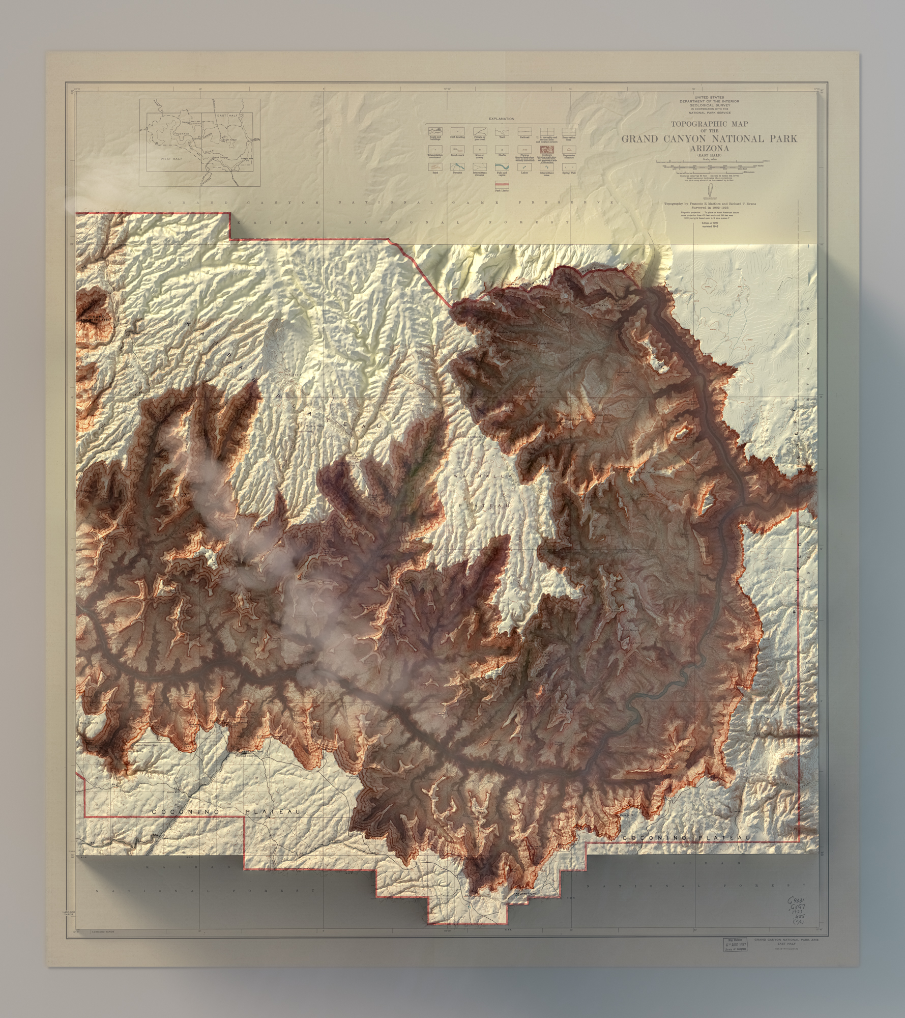
Grand Canyon - Arizona
USGS map of 1962
3D rendered topographic maps (dusk / dawn)
Manhattan - NYC


Geological map of the Colorado River - 1858


Virginia - 1863
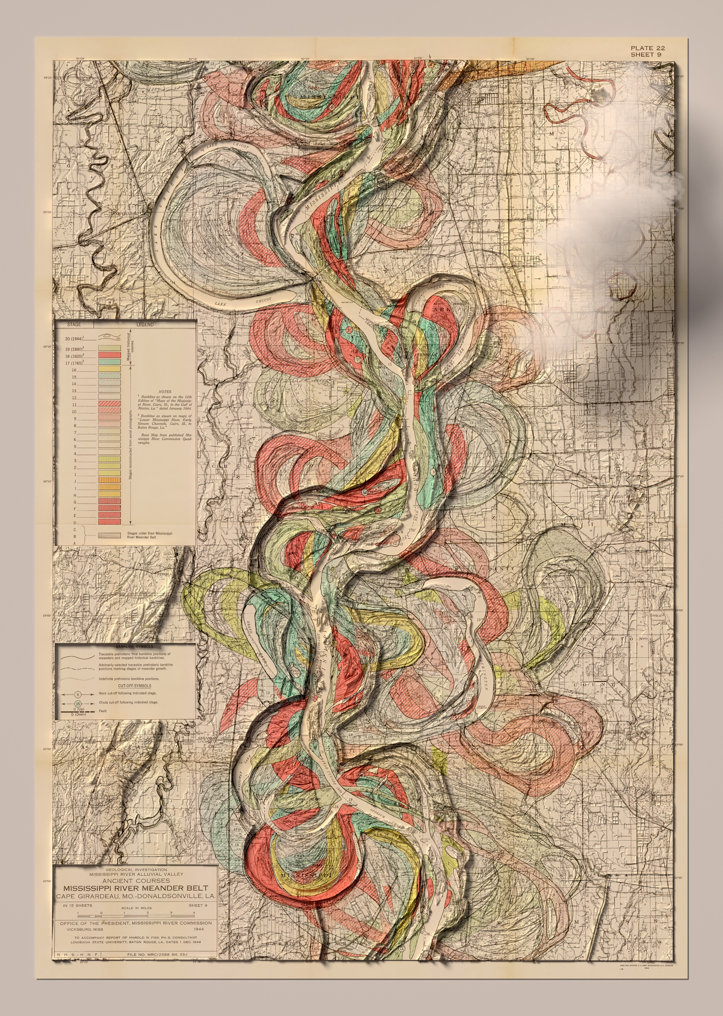
Mississippi Delta - 1855
Geological map of Tennessee - 1869
Washington State - 1887
New York State - Transportation map - 1977

Rail roads of New Jersey - Van Cleef & Betts - 1887
Topographic map of Colorado - USGS - 1913


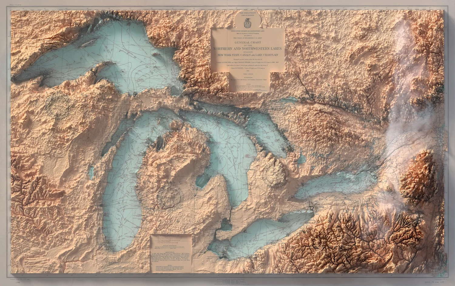
Great Lakes
Nautical map - Corps of Engineers, U.S. Army - 1921
San Francisco - USGS - 1954
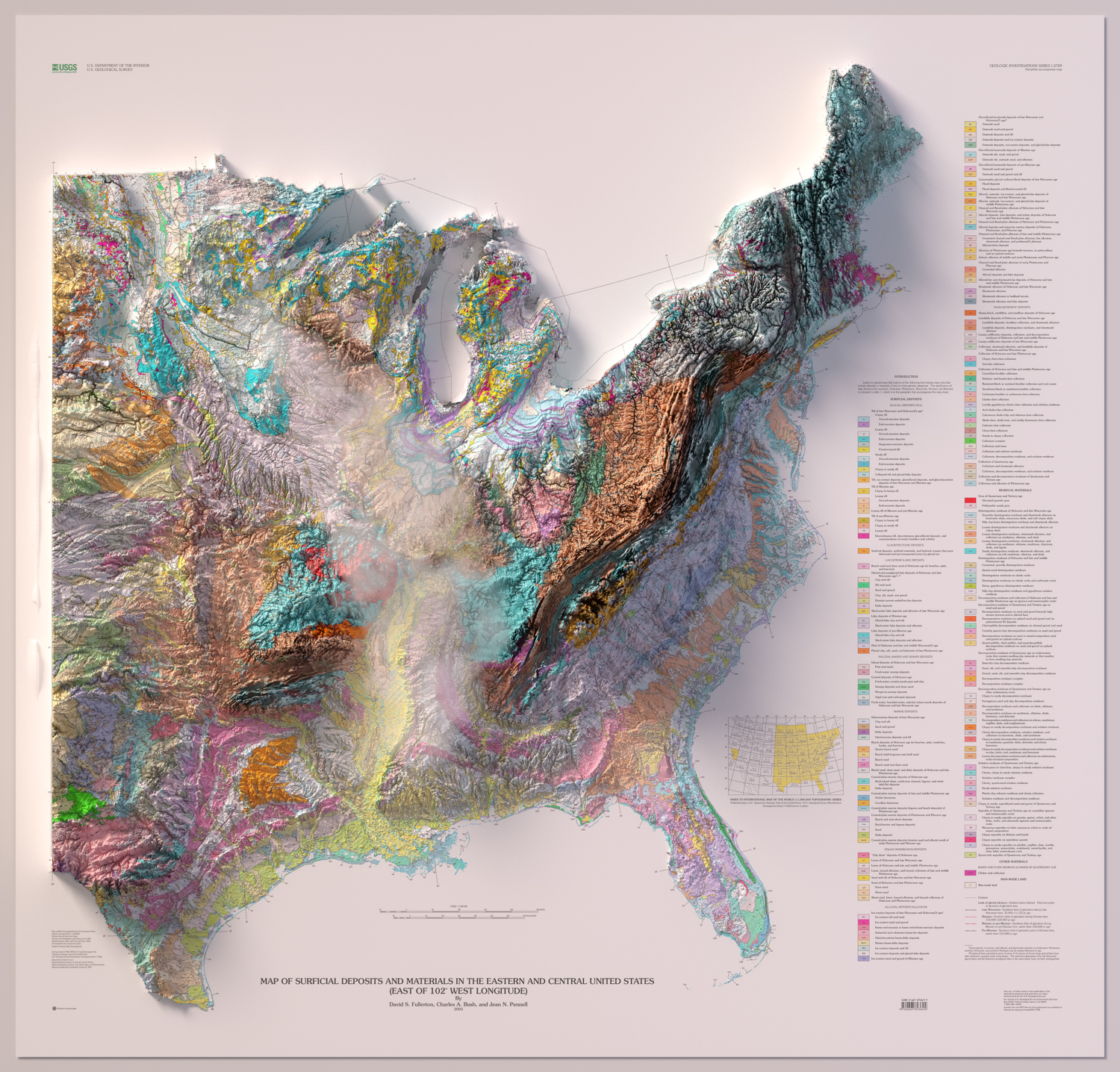
Surficial deposits -Eastern and Central United States
2003

Alaska - Topography
U.S. Geological Survey / U.S. Coast & Geodetic Survey

State of Texas
Pressler - 1838
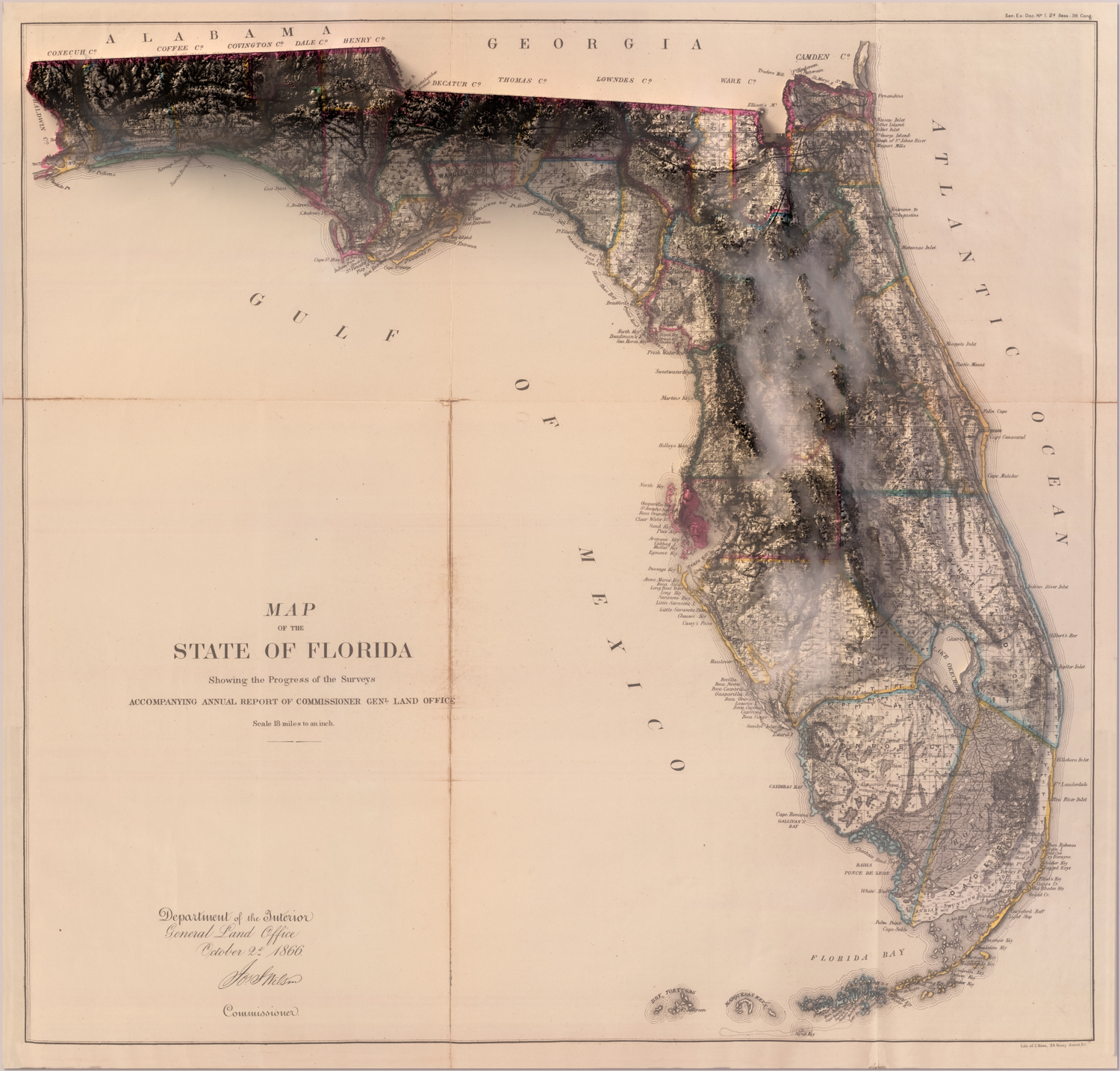
State of Florida
General Land Office - 1866

State of Texas
General Soil Map - 1973
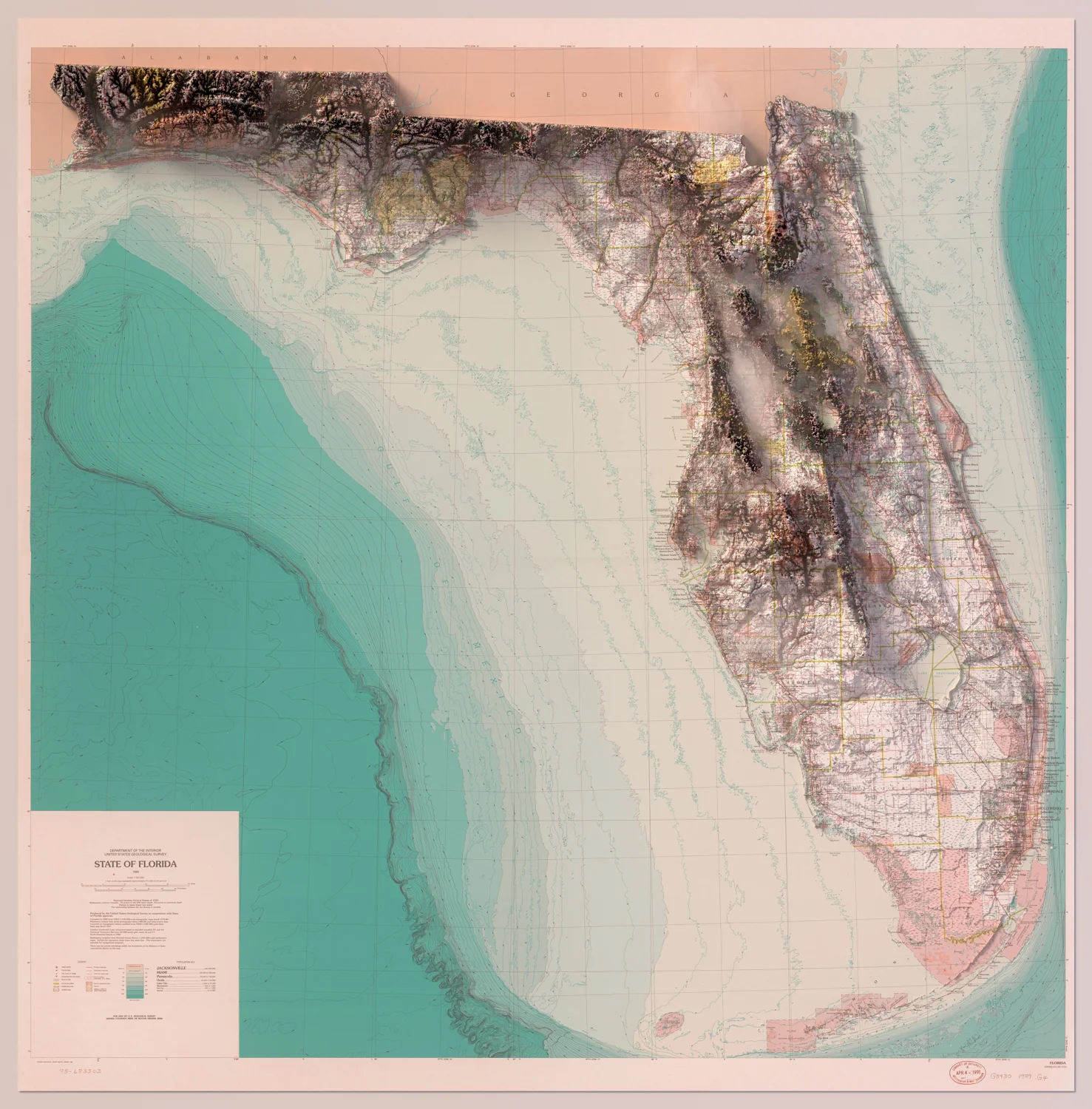
State of Florida
U.S. Geological Survey - 1989

Territory of
New Mexico
1896

Territory of
New Mexico
Shell Road Map - 1956

Puerto Rico
1899

Territory of Wyoming
Shell Highway Map of 1950

Mount Riley -
New Mexico
USGS Map of 1929

Mesa Verde -
National Park
Colorado
Topographic Map - USGS - 1911

Deming -
New Mexico
USGS - Map of 1910

San Francisco and Vicinity
USGS - Map of 1915

Grand Canyon - National Park
Arizona

Mount Baker -
Washington State
USGS - 1909

TUCSON - ARIZONA
Topographic map - 1956

Territory of UTAH
Shell Highway Map - ~ 1960

Washington State-
Lake Chelan
USGS - 1901

3 SISTERS-
OREGON
USGS - 1929

FLAGSTAFF-
ARIZONA
USGS - 1929

Grand Canyon
Geology
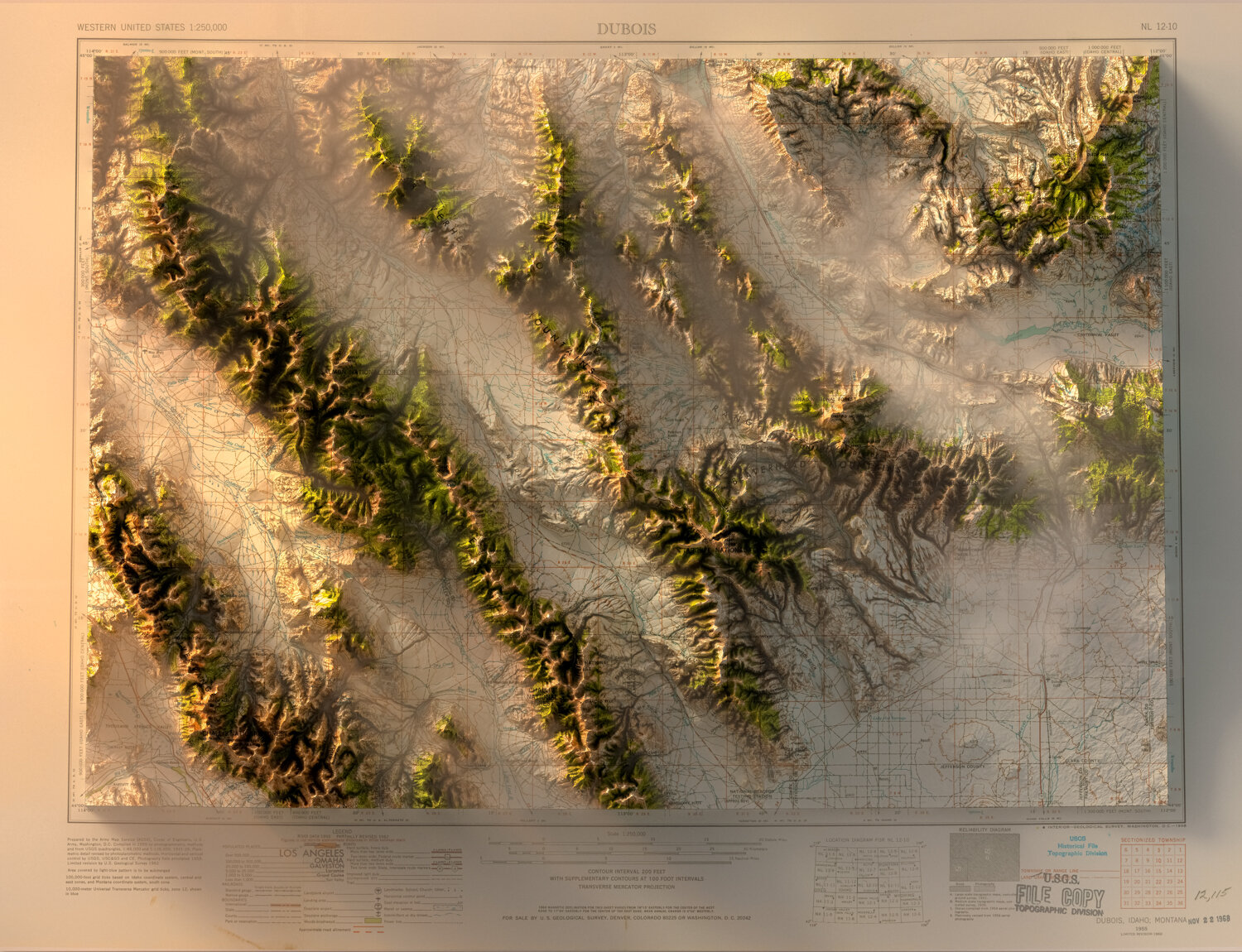
DUBOIS - WYOMING
USGS - 1968
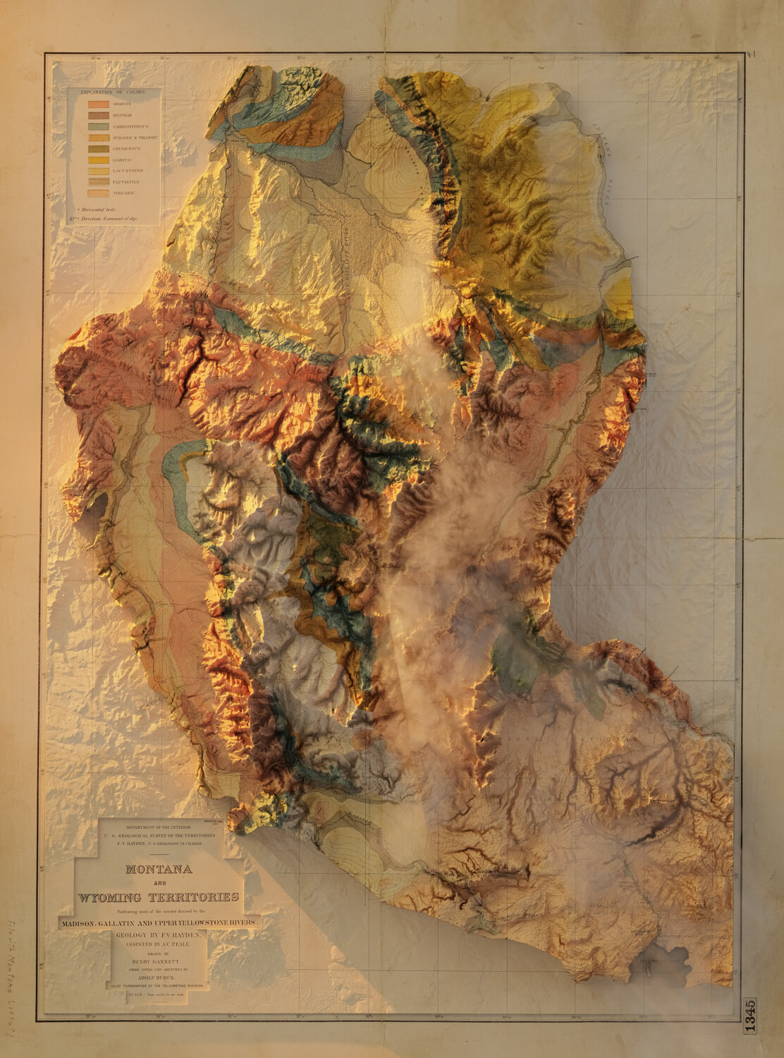
MONTANA & WYOMING
Geological Map - USGS

BORAH PEAK - IDAHO/MONTANA
USGS - 1989

COLORADO
Geological Map - Rand McNally - 1880

Olympic Peninsula / Washington State
Geological Map - USGS - 1979

Geologic map - Utah
Utah State Land Board - 1962

Wrangell-Saint Elias National Park - Alaska
USGS - 2006

Grand Canyon - National Park
Geology

Big Bend National Park
Geologic map - Texas

Uinta Mountains - Utah & Wyoming
Geological Map - 2009